
Paragrant Bay is one of the more challenging hikes in Trinidad and Tobago, however, the views that you get as you hike down to the beach, especially if you take the route through Paramin, are second to none 🥰. This hike gives meaning to the quote “It is easier to go down a hill than up, but the view is from the top.” – Arnold Bennett … because trust me, although the views heading downhill are amazing, the hike back to the top of the mountain from the beach is a tough one 🌄.

On Saturday 8th October, the Hikers United Team organized a hike to the lovely Paragrant Bay 🏖. This beach is another one of the hidden gems of Trinidad’s North Coast. Some of my other favorites that are located very close by include: Cyril Bay, Negmawah Bay and Pichon Cove, however, Paragrant Bay was the most challenging hike with Pichon Cove and Cyril Bay being the easiest.
After a week of heavy rains and flooding, we were blessed to have clear blue skies and brilliant sunshine on our hike day and as we assembled at the top of Mal D’esto-Mac (Bad Stomach) road, we were excited for the adventure that lay ahead of us ☺️.


There are two ways to hike to Paragrant Bay, one is by hiking down Mal Desto-Mac road in Paramin and the other is using a private road to the right of North Deck (where they now charge a fee of $20 per person to enter). We used the Paramin route 😎.
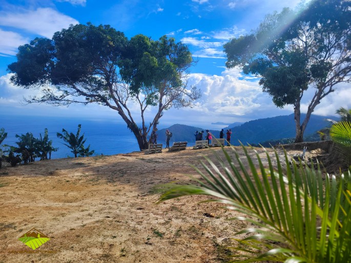
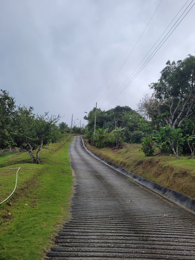
The total distance from where we parked our cars, down to the beach was approximately 3km. The hike began along the very wide concrete road which snaked downhill through the Paramin hills 🌲 🌳. It provided some of the most beautiful views of Saut D’Eau island and La Vache Bay. We were on the road for about 1.8 km until we entered into the short dirt road and then a trail through the forest to the right of the last house. At some points, this trail became very thin and you needed to be careful and watch your steps or you could be taking a tumble down the hill.

Along the way, we passed an area with some of the biggest razor grass that I have ever seen in my life, so if you are going to do this hike, I strongly suggest you wear long sleeve tops and pants. Thankfully, this was a very small patch of razor grass and most of the trail was quite wide and scenic as you hiked through the forest 😃.


Overall, we took 1hr 20 mins on our way down to the beach. We took our time going downhill even along the roadway because it is so steep and we also stopped several times to enjoy the lovely views and take pictures 📸. This was the first time in a long while that I felt my toes jamming on the inside of my sneakers…..so make sure you wear socks and comfortable sneakers for this hike. I was worried that I may even lose a toe nail because of this and I really am not about that life! 🙄

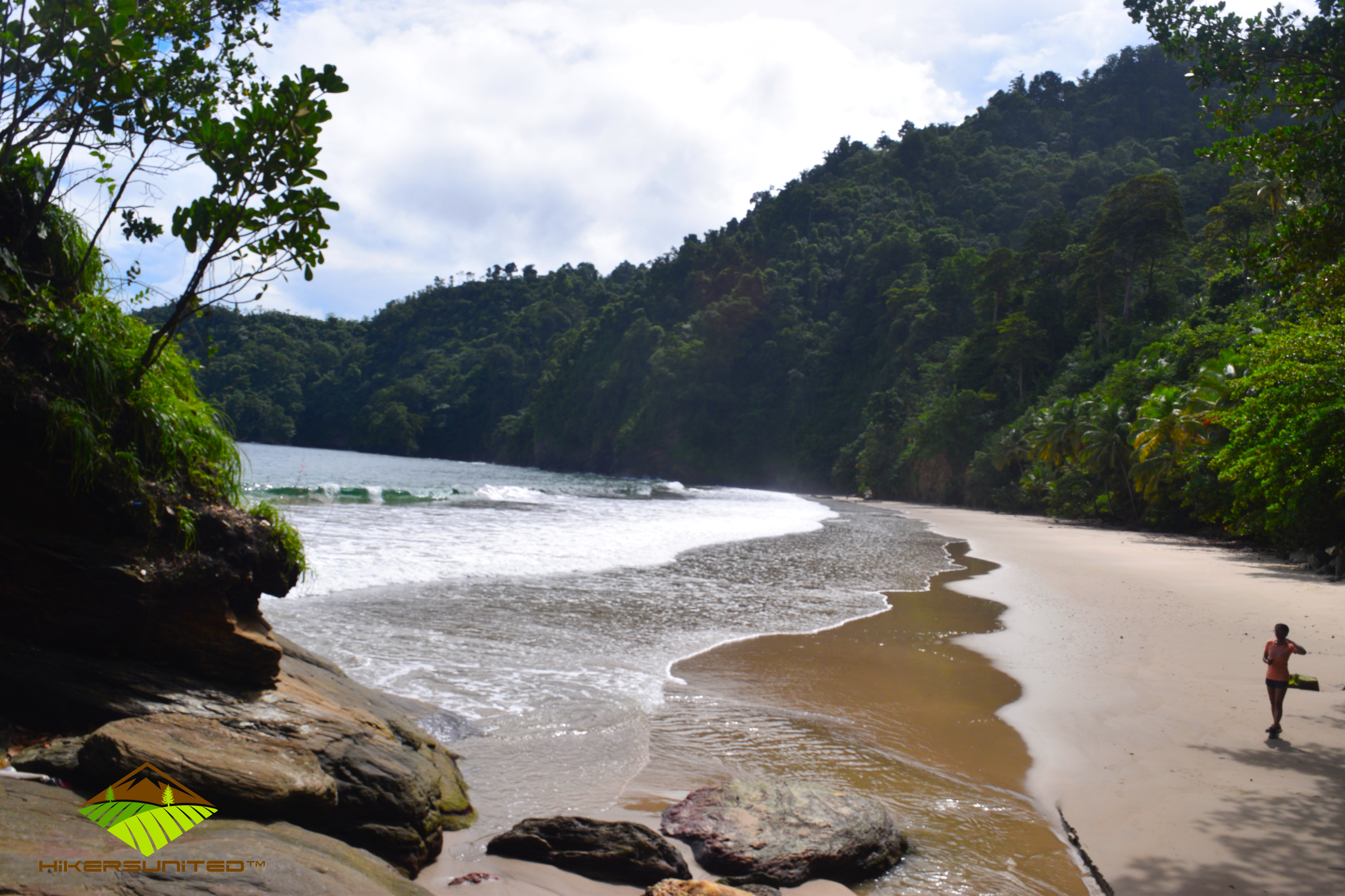
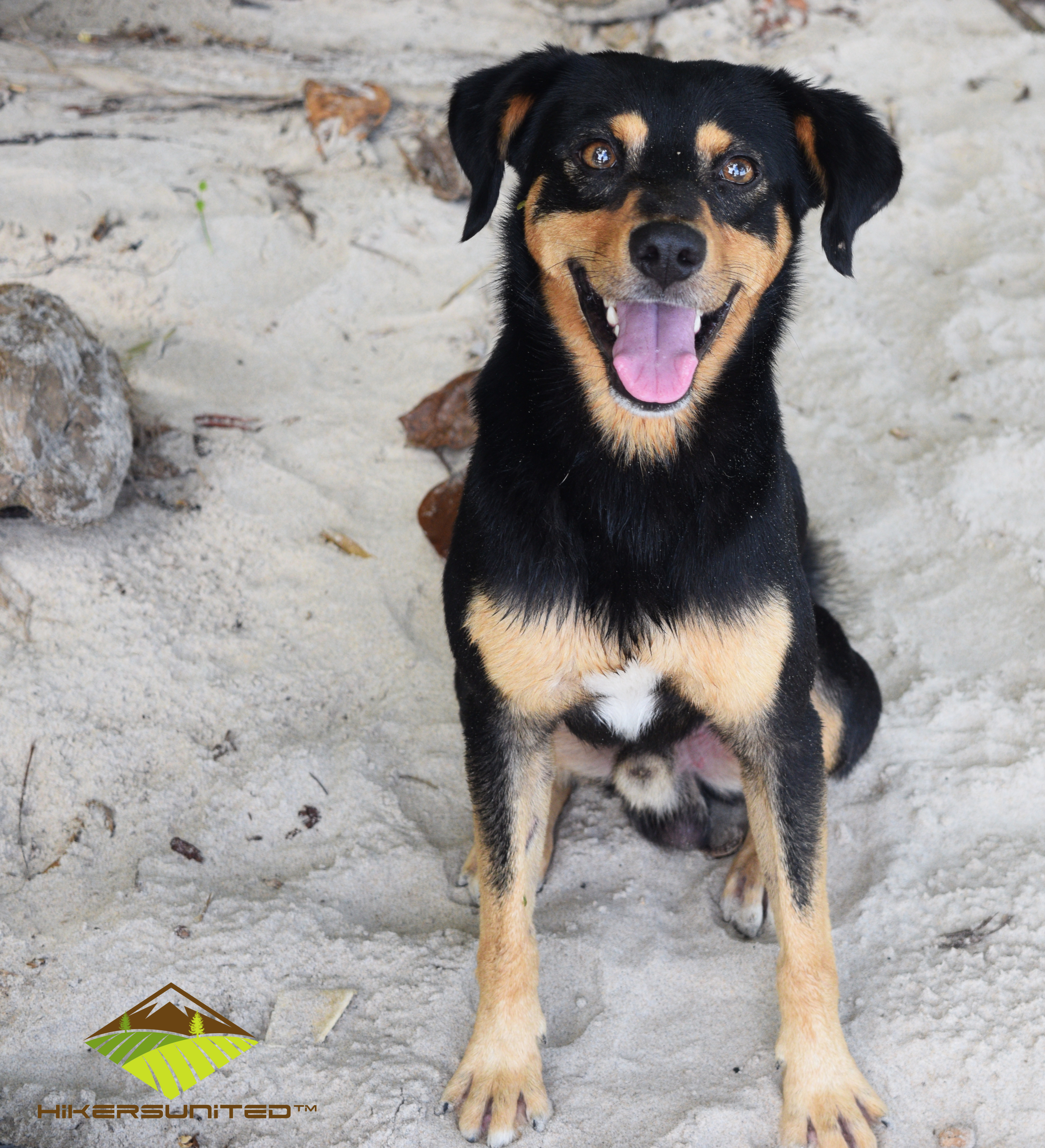
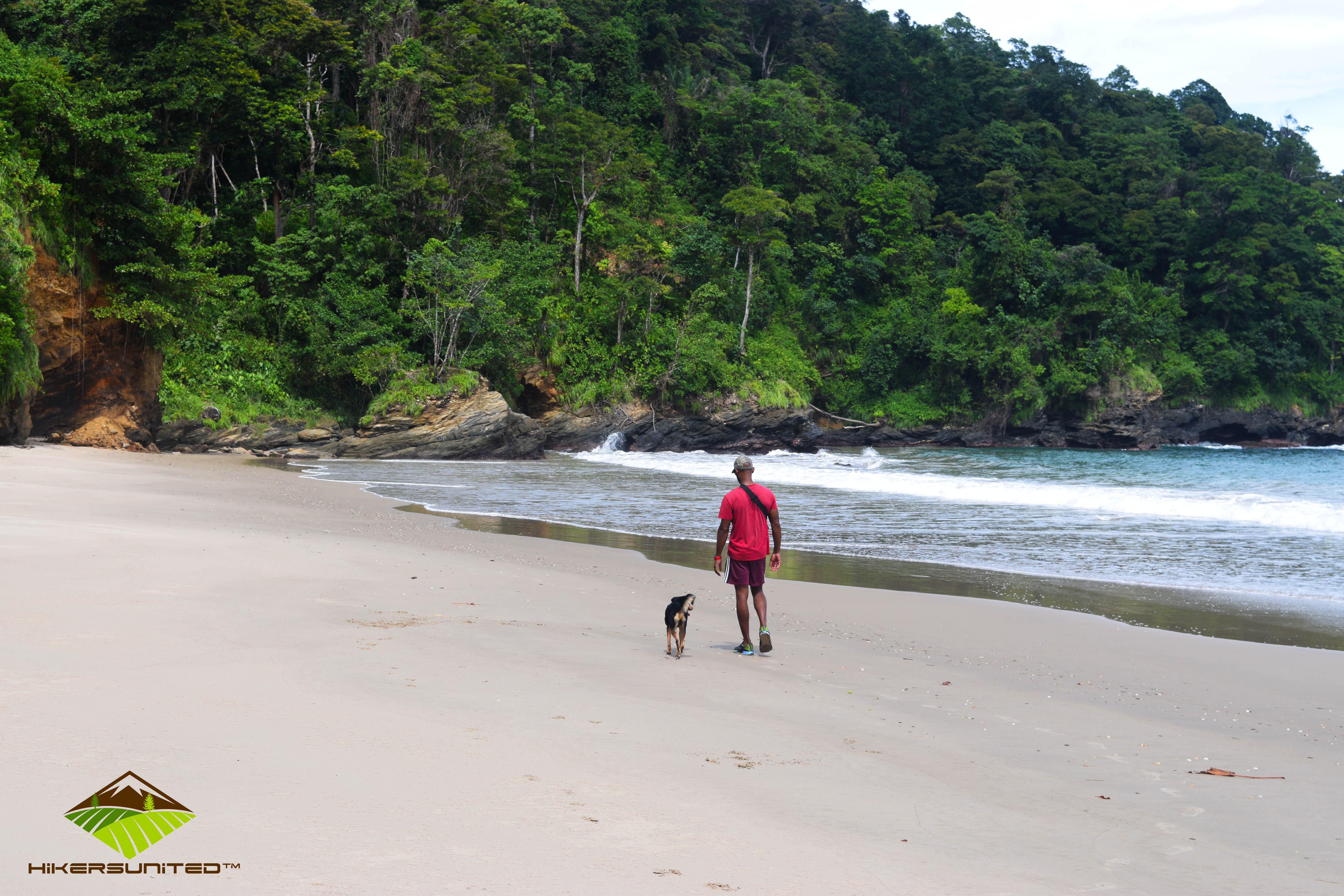
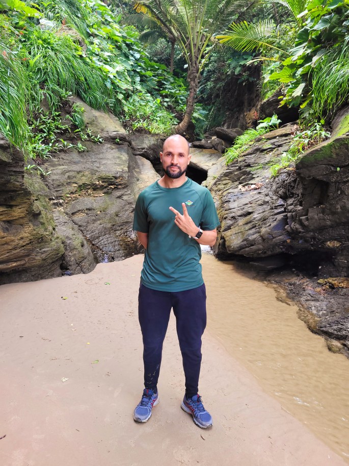
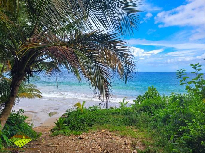
We entered the beach on the western end and made our way down to the rocks. By this time it was around 9:45 am. Our first stop was a stream with a small water feature where we all immediately washed our faces and relaxed. As is often the case, there was no one else at this beach 💦, so we had the entire beach to ourselves for most of the morning. Our only company for most of the time, was some very friendly dogs who just wanted to play and eat any food 🥯 🍞🍎that we gave to them.
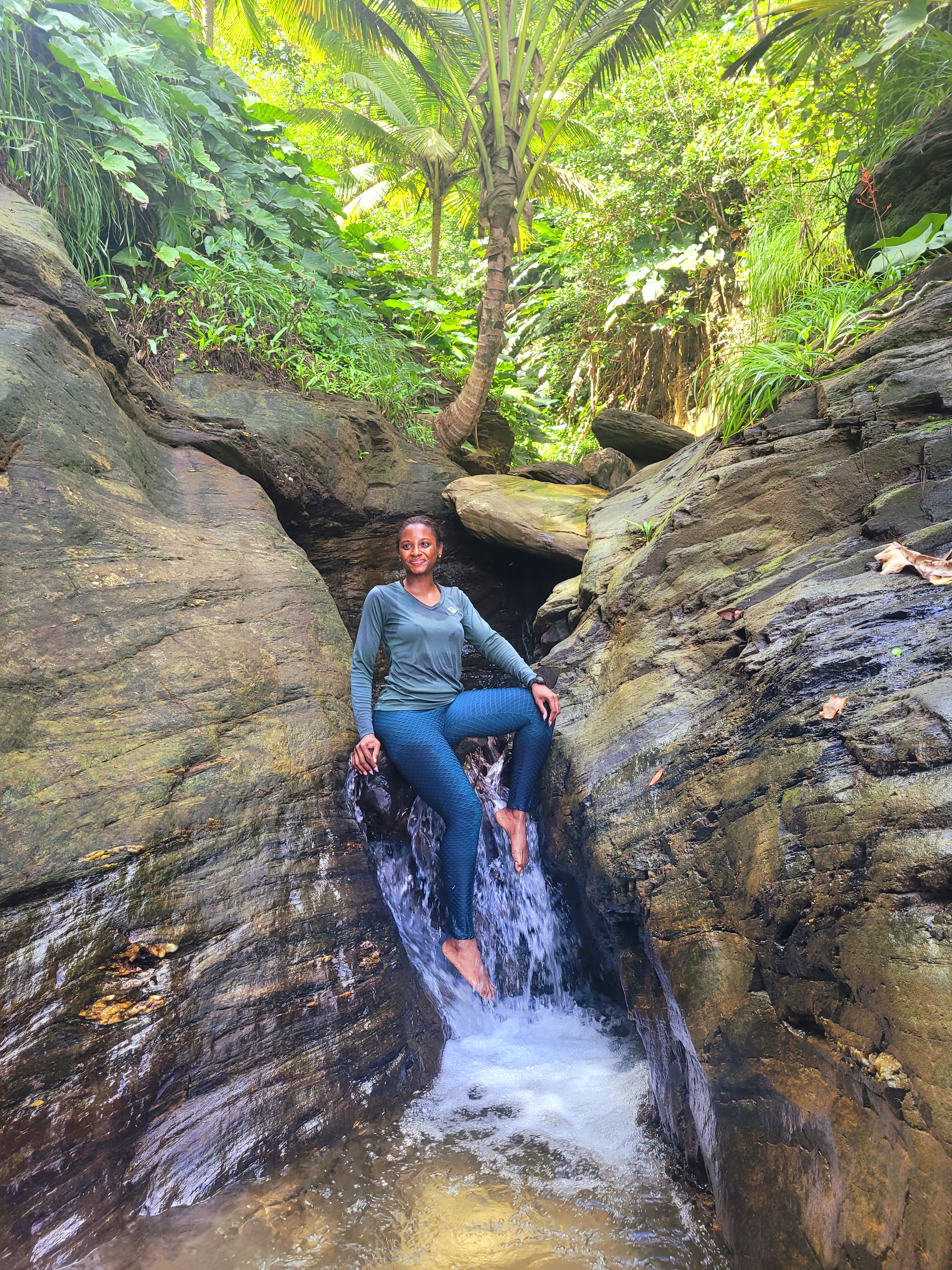
As we all knew that the return journey would be challenging, most of us took the opportunity to bathe in the beach. I mean, I didn’t hike all this way to not go in the water right? 🤨
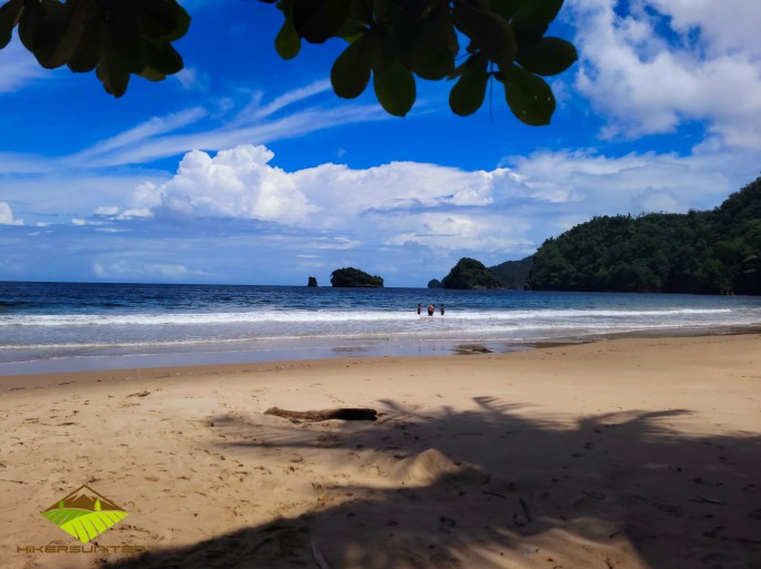
The water was cool and although the waves were big, it was calmer than Maracas is at times. We had a great time bathing in the water and relaxing on the sand for a bit 🏖. After about 1 1/2 hours, we decided that it was time to begin our trek back and at around 11:30 am we were back on the trail.
The hike back to the top of Mal Desto-Mac road was challenging for sure (walking up stairs for the next 3 days was pressure after this hike! 😩 🥺 😢). It took us 2hrs and 20 mins to reach back to our cars. Of course, we took our time and had frequent water breaks and rest stops along the way. Also, God was really on our side because on the one hand when we were heading to the beach, it was brilliant sunshine ☀️ and clear blue skies, on our return, it was overcast 🌦 and it even had a light drizzle for five minutes that cooled us down. It was the perfect weather to hike back up that hill (it would have been pressure if we had the midday sun bearing down on us).
Tip: when going uphill, it is easier to Zig-Zag your way up rather than walking in a straight line.

Unfortunately, I walked with only one water bottle so I was running low on water on my way back up the hill although I did not drink any on my way to the beach. Thankfully, our captain Khallid suggested that we all stop by “Dougla’s” house for some water 💧 on our way up the hill. At this point, we had already made it about 60% of the way back to the cars and we needed and wanted this break. The family was so gracious, they kindly filled all of our water bottles with some cool fresh water that was everything we wanted and needed in that moment. It gave us the boost we needed and we were now recharged and ready to make that final push to the end 🤗.
By 2:00 pm, we were back at our cars, talking and reminiscing on today’s adventure. The dogs who were with us at the beach, actually followed us all the way up the hill and kept us company. All in all, it was an amazing hike and a very memorable, fun day 😍.
Tips for this hike:
- This is not a hike to try as your first hike but if you have done Paria before, can do the Bamboo Cathedral trail / Chancellor Hill / Breezy Hill / Hololo trek comfortably then you should be okay. The main challenge is on the return journey which is approximately a 3km uphill trek on a winding road up the side of the mountain if you use the Paramin route.
- Long sleeve tops and pants are suggested
- Have a good breakfast. You can also bring some sandwiches or fruits / nuts to eat.
- Bring at least 2 bottles of water and some juice or gatorade.
- Apply some sunblock / sunscreen. Most of the hike is along the uncovered roadway.

Have you hiked to Paragrant before? What was your experience? 😁
Much Love,
Celly

As always; I thoroughly enjoyed your commentary.
I feel as though I am accompanying you on the hike.
Hope you are complying all these blogs for a future book.
Stay safe….Aunt B
LikeLiked by 1 person
Thanks Aunty, yes maybe one day I can publish a book on these adventures. Thanks for reading my blog 🙂
LikeLike
Just so you know, I love the book idea! God spent a little extra time when creating the Caribbean, I’m convinced. I prefer hiking under tree cover, but this view is worth a lil sun
LikeLiked by 1 person
LOLOL. Thanks hun, one day I shall follow in your footsteps. I still have your book and have it handy for my next Jam trip 🙂 . Yes gyal, this hike is worth the views for sure
LikeLiked by 1 person
I did this trail…among others…some years ago. I considered myself a seasoned trail rat. It was very tough!! Brought back a pack full of seasonings that were just growing along the roadside. Awesome natural vibe, beautiful view. Unforgettable.
LikeLike